|
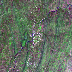
Landsat TM (1990)

zoom |
|
|
Path: 190; Row: 052
Data within tile: 100.0
|
|
Date: 1986/11/15
Cloud cover: 2.2
|
|
NDVI at image date: 73% of annual maximum
 Downolad image data [zip] Downolad image data [zip]
|
|

zoom |
|
|
Path: 191; Row: 052
Data within tile: 69.2
|
|
Date: 1990/11/25
Cloud cover: 0.0
|
|
NDVI at image date: 60% of annual maximum
Downolad image data [zip]
|
|
|
|
|
Landsat ETM+ (2000)

zoom |
|
|
Path: 190; Row: 052
Data within tile: 100.0
|
|
Date: 2000/11/13
Cloud cover: 0.0
|
|
NDVI at image date: 73% of annual maximum
Downolad image data [zip]
|
|

zoom |
|
|
Path: 191; Row: 052
Data within tile: 87.7
|
|
Date: 1999/11/18
Cloud cover: 0.0
|
|
NDVI at image date: 60% of annual maximum
Downolad image data [zip]
|
|
|
|
|
Landsat ETM+ (2005)

zoom |
|
|
Path: 190; Row: 052
Data within tile: 100.0
|
|
Date: 2005/11/11
Cloud cover: 0.0
|
|
NDVI at image date: 73% of annual maximum
Downolad image data [zip]
|
|

zoom |
|
|
Path: 191; Row: 052
Data within tile: 87.5
|
|
Date: 2005/09/15
Cloud cover: 0.0
|
|
NDVI at image date: 100% of annual maximum
Downolad image data [zip]
|
|
|