|
Landsat TM (1990)

zoom |
|
|
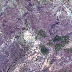
Path: 192; Row: 035
Data within tile: 100.0
|
|
Date: 1988/01/27
Cloud cover: 15.9
|
|
NDVI at image date: 83% of annual maximum
 Downolad image data [zip] Downolad image data [zip]
|
|

zoom |
|
|
Path: 193; Row: 035
Data within tile: 100.0
|
|
Date: 1987/06/16
Cloud cover: 0.1
|
|
NDVI at image date: 68% of annual maximum
Downolad image data [zip]
|
|
|
|
|
Landsat ETM+ (2000)

zoom |
|
|
Path: 192; Row: 035
Data within tile: 100.0
|
|
Date: 2000/05/03
Cloud cover: 0.5
|
|
NDVI at image date: 92% of annual maximum
Downolad image data [zip]
|
|

zoom |
|
|
Path: 193; Row: 035
Data within tile: 100.0
|
|
Date: 2000/04/24
Cloud cover: 0.2
|
|
NDVI at image date: 92% of annual maximum
Downolad image data [zip]
|
|
|
|
|
Landsat ETM+ (2005)

zoom |
|
|
Path: 192; Row: 035
Data within tile: 100.0
|
|
Date: 2005/05/01
Cloud cover: 0.0
|
|
NDVI at image date: 92% of annual maximum
Downolad image data [zip]
|
|
|