|
Landsat TM (1990)

zoom |
|
|
Path: 185; Row: 058
Data within tile: 98.5
|
|
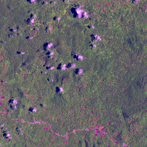
Date: 1987/10/14
Cloud cover: 100.0
|
|
NDVI at image date: 87% of annual maximum
 Downolad image data [zip] Downolad image data [zip]
|
|
|
|
|
Landsat ETM+ (2000)

zoom |
|
|
Path: 185; Row: 058
Data within tile: 100.0
|
|
Date: 2001/03/18
Cloud cover: 0.8
|
|
NDVI at image date: 96% of annual maximum
Downolad image data [zip]
|
|
|
|
|
Landsat ETM+ (2005)

zoom |
|
|
Path: 185; Row: 058
Data within tile: 59.2
|
|
Date: 2005/01/08
Cloud cover: 91.5
|
|
NDVI at image date: 98% of annual maximum
Downolad image data [zip]
|
|

zoom |
|
|
Path: 185; Row: 058
Data within tile: 59.8
|
|
Date: 2005/11/08
Cloud cover: 11.1
|
|
NDVI at image date: 94% of annual maximum
Downolad image data [zip]
|
|
|