|
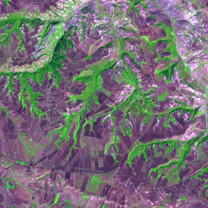
Landsat TM (1990)

zoom |
|
|
Path: 188; Row: 032
Data within tile: 100.0
|
|
Date: 1987/06/13
Cloud cover: 0.0
|
|
NDVI at image date: 44% of annual maximum
 Downolad image data [zip] Downolad image data [zip]
|
|
|
|
|
Landsat ETM+ (2000)

zoom |
|
|
Path: 188; Row: 032
Data within tile: 100.0
|
|
Date: 1999/09/26
Cloud cover: 0.0
|
|
NDVI at image date: 44% of annual maximum
Downolad image data [zip]
|
|
|
|
|
Landsat ETM+ (2005)

zoom |
|
|
Path: 188; Row: 032
Data within tile: 100.0
|
|
Date: 2007/10/02
Cloud cover: 0.0
|
|
NDVI at image date: 43% of annual maximum
Downolad image data [zip]
|
|
|