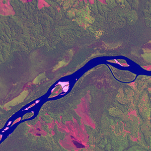
Global Forest Resources Assessment

Food and Agriculture Organization of the UN
GIScCE, South Dakota State University


e021s04


Location


4° S; 21° E
Africa; Democratic Republic of the Congo (Kasai-Occidental)
Elevation of the tile center point: 294 m
Water consist 6.2% of block area


Biome/ecoregion


Tropical & Subtropical Moist Broadleaf Forests biome
Central Congolian lowland forests ecoregion


External information resources


The Degree Confluence Project information


Tile outlines


 Tile outline 10x10km and 20x20km [KMZ]
 Tile outline 10x10km [SHP]
 Tile outline 20x20km [SHP]


Landsat TM (1990)


     zoom

Path: 178; Row: 063


Data within tile: 100.0


Date: 1992/09/24


Cloud cover: 1.6


NDVI at image date: 94% of annual maximum


 Downolad image data [zip]


Landsat ETM+ (2000)


     zoom

Path: 178; Row: 063


Data within tile: 100.0


Date: 2002/06/24


Cloud cover: 0.0


NDVI at image date: 98% of annual maximum


 Downolad image data [zip]


Landsat ETM+ (2005)