|
Landsat TM (1990)

zoom |
|
|
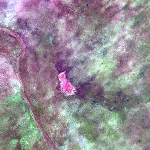
Path: 173; Row: 075
Data within tile: 100.0
|
|
Date: 1991/03/11
Cloud cover: 0.0
|
|
NDVI at image date: 100% of annual maximum
 Downolad image data [zip] Downolad image data [zip]
|
|

zoom |
|
|
Path: 174; Row: 075
Data within tile: 100.0
|
|
Date: 1990/05/02
Cloud cover: 0.0
|
|
NDVI at image date: 80% of annual maximum
Downolad image data [zip]
|
|
|
|
|
Landsat ETM+ (2000)

zoom |
|
|
Path: 173; Row: 075
Data within tile: 100.0
|
|
Date: 2001/05/17
Cloud cover: 0.0
|
|
NDVI at image date: 71% of annual maximum
Downolad image data [zip]
|
|

zoom |
|
|
Path: 174; Row: 075
Data within tile: 100.0
|
|
Date: 2000/01/30
Cloud cover: 0.0
|
|
NDVI at image date: 92% of annual maximum
Downolad image data [zip]
|
|
|
|
|
Landsat ETM+ (2005)

zoom |
|
|
Path: 173; Row: 075
Data within tile: 98.9
|
|
Date: 2005/05/12
Cloud cover: 0.0
|
|
NDVI at image date: 71% of annual maximum
Downolad image data [zip]
|
|
|