|
Landsat TM (1990)

zoom |
|
|
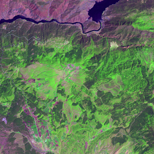
Path: 178; Row: 032
Data within tile: 100.0
|
|
Date: 1987/09/11
Cloud cover: 6.9
|
|
NDVI at image date: 85% of annual maximum
 Downolad image data [zip] Downolad image data [zip]
|
|

zoom |
|
|
Path: 179; Row: 032
Data within tile: 100.0
|
|
Date: 1987/09/18
Cloud cover: 1.8
|
|
NDVI at image date: 85% of annual maximum
Downolad image data [zip]
|
|
|
|
|
Landsat ETM+ (2000)

zoom |
|
|
Path: 178; Row: 032
Data within tile: 100.0
|
|
Date: 2000/07/04
Cloud cover: 0.0
|
|
NDVI at image date: 84% of annual maximum
Downolad image data [zip]
|
|

zoom |
|
|
Path: 179; Row: 032
Data within tile: 100.0
|
|
Date: 2001/06/12
Cloud cover: 0.0
|
|
NDVI at image date: 86% of annual maximum
Downolad image data [zip]
|
|
|
|
|
Landsat ETM+ (2005)

zoom |
|
|
Path: 178; Row: 032
Data within tile: 100.0
|
|
Date: 2006/07/21
Cloud cover: 0.0
|
|
NDVI at image date: 82% of annual maximum
Downolad image data [zip]
|
|

zoom |
|
|
Path: 179; Row: 032
Data within tile: 83.6
|
|
Date: 2005/07/09
Cloud cover: 0.2
|
|
NDVI at image date: 84% of annual maximum
Downolad image data [zip]
|
|
|