|
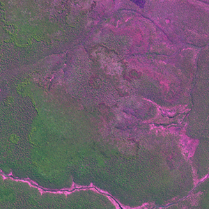
Landsat TM (1990)

zoom |
|
|
Path: 166; Row: 067
Data within tile: 100.0
|
|
Date: 1993/05/18
Cloud cover: 0.0
|
|
NDVI at image date: 98% of annual maximum
 Downolad image data [zip] Downolad image data [zip]
|
|
|
|
|
Landsat ETM+ (2000)

zoom |
|
|
Path: 166; Row: 067
Data within tile: 100.0
|
|
Date: 2000/05/29
Cloud cover: 0.0
|
|
NDVI at image date: 95% of annual maximum
Downolad image data [zip]
|
|
|
|
|
Landsat ETM+ (2005)

zoom |
|
|
Path: 166; Row: 067
Data within tile: 80.8
|
|
Date: 2004/05/08
Cloud cover: 6.4
|
|
NDVI at image date: 98% of annual maximum
Downolad image data [zip]
|
|

zoom |
|
|
Path: 166; Row: 067
Data within tile: 79.8
|
|
Date: 2006/07/17
Cloud cover: 0.0
|
|
NDVI at image date: 80% of annual maximum
Downolad image data [zip]
|
|
|