|
Landsat TM (1990)

zoom |
|
|
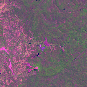
Path: 164; Row: 069
Data within tile: 100.0
|
|
Date: 1989/05/09
Cloud cover: 0.2
|
|
NDVI at image date: 92% of annual maximum
 Downolad image data [zip] Downolad image data [zip]
|
|

zoom |
|
|
Path: 165; Row: 069
Data within tile: 68.7
|
|
Date: 1991/05/06
Cloud cover: 0.0
|
|
NDVI at image date: 96% of annual maximum
Downolad image data [zip]
|
|
|
|
|
Landsat ETM+ (2000)

zoom |
|
|
Path: 164; Row: 069
Data within tile: 100.0
|
|
Date: 2000/05/31
Cloud cover: 0.0
|
|
NDVI at image date: 85% of annual maximum
Downolad image data [zip]
|
|

zoom |
|
|
Path: 165; Row: 069
Data within tile: 100.0
|
|
Date: 2002/07/15
Cloud cover: 0.0
|
|
NDVI at image date: 63% of annual maximum
Downolad image data [zip]
|
|
|
|
|
Landsat ETM+ (2005)

zoom |
|
|
Path: 164; Row: 069
Data within tile: 60.8
|
|
Date: 2004/07/13
Cloud cover: 0.0
|
|
NDVI at image date: 63% of annual maximum
Downolad image data [zip]
|
|

zoom |
|
|
Path: 164; Row: 069
Data within tile: 61.4
|
|
Date: 2005/03/10
Cloud cover: 23.1
|
|
NDVI at image date: 97% of annual maximum
Downolad image data [zip]
|
|

zoom |
|
|
Path: 165; Row: 069
Data within tile: 100.0
|
|
Date: 2004/07/04
Cloud cover: 0.0
|
|
NDVI at image date: 70% of annual maximum
Downolad image data [zip]
|
|
|