|
Landsat TM (1990)

zoom |
|
|
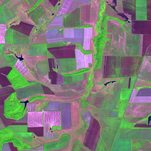
Path: 174; Row: 025
Data within tile: 100.0
|
|
Date: 1989/06/08
Cloud cover: 0.1
|
|
NDVI at image date: 92% of annual maximum
 Downolad image data [zip] Downolad image data [zip]
|
|

zoom |
|
|
Path: 174; Row: 025
Data within tile: 100.0
|
|
Date: 1988/07/31
Cloud cover: 0.0
|
|
NDVI at image date: 89% of annual maximum
Downolad image data [zip]
|
|

zoom |
|
|
Path: 175; Row: 024
Data within tile: 100.0
|
|
Date: 1988/07/30
Cloud cover: 4.1
|
|
NDVI at image date: 89% of annual maximum
Downolad image data [zip]
|
|

zoom |
|
|
Path: 175; Row: 024
Data within tile: 100.0
|
|
Date: 1991/07/31
Cloud cover: 0.2
|
|
NDVI at image date: 89% of annual maximum
Downolad image data [zip]
|
|

zoom |
|
|
Path: 175; Row: 024
Data within tile: 100.0
|
|
Date: 1994/09/09
Cloud cover: 0.0
|
|
NDVI at image date: 72% of annual maximum
Downolad image data [zip]
|
|
|
|
|
Landsat ETM+ (2000)

zoom |
|
|
Path: 174; Row: 025
Data within tile: 100.0
|
|
Date: 2002/07/30
Cloud cover: 0.0
|
|
NDVI at image date: 89% of annual maximum
Downolad image data [zip]
|
|

zoom |
|
|
Path: 175; Row: 024
Data within tile: 100.0
|
|
Date: 2002/07/21
Cloud cover: 0.0
|
|
NDVI at image date: 97% of annual maximum
Downolad image data [zip]
|
|
|
|
|
Landsat ETM+ (2005)

zoom |
|
|
Path: 174; Row: 025
Data within tile: 70.0
|
|
Date: 2005/09/08
Cloud cover: 0.1
|
|
NDVI at image date: 72% of annual maximum
Downolad image data [zip]
|
|

zoom |
|
|
Path: 174; Row: 025
Data within tile: 70.7
|
|
Date: 2005/09/24
Cloud cover: 1.9
|
|
NDVI at image date: 64% of annual maximum
Downolad image data [zip]
|
|

zoom |
|
|
Path: 175; Row: 024
Data within tile: 100.0
|
|
Date: 2007/09/29
Cloud cover: 0.0
|
|
NDVI at image date: 64% of annual maximum
Downolad image data [zip]
|
|
|