|
Landsat TM (1990)

zoom |
|
|
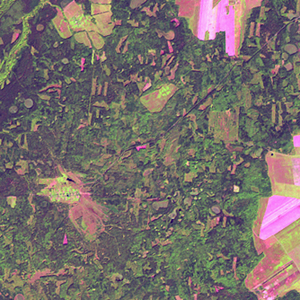
Path: 175; Row: 022
Data within tile: 100.0
|
|
Date: 1988/08/23
Cloud cover: 0.0
|
|
NDVI at image date: 95% of annual maximum
 Downolad image data [zip] Downolad image data [zip]
|
|

zoom |
|
|
Path: 176; Row: 022
Data within tile: 100.0
|
|
Date: 1994/09/16
Cloud cover: 0.0
|
|
NDVI at image date: 90% of annual maximum
Downolad image data [zip]
|
|
|
|
|
Landsat ETM+ (2000)

zoom |
|
|
Path: 175; Row: 022
Data within tile: 100.0
|
|
Date: 2000/05/28
Cloud cover: 0.3
|
|
NDVI at image date: 95% of annual maximum
Downolad image data [zip]
|
|

zoom |
|
|
Path: 176; Row: 022
Data within tile: 100.0
|
|
Date: 1999/09/06
Cloud cover: 0.0
|
|
NDVI at image date: 93% of annual maximum
Downolad image data [zip]
|
|
|
|
|
Landsat ETM+ (2005)

zoom |
|
|
Path: 175; Row: 022
Data within tile: 87.8
|
|
Date: 2005/08/14
Cloud cover: 0.0
|
|
NDVI at image date: 95% of annual maximum
Downolad image data [zip]
|
|

zoom |
|
|
Path: 176; Row: 022
Data within tile: 100.0
|
|
Date: 2005/05/17
Cloud cover: 0.0
|
|
NDVI at image date: 94% of annual maximum
Downolad image data [zip]
|
|
|