|
Landsat TM (1990)

zoom |
|
|
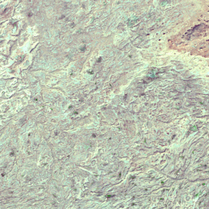
Path: 169; Row: 039
Data within tile: 100.0
|
|
Date: 1990/03/04
Cloud cover: 0.5
|
|
NDVI at image date: 100% of annual maximum
 Downolad image data [zip] Downolad image data [zip]
|
|

zoom |
|
|
Path: 170; Row: 039
Data within tile: 91.0
|
|
Date: 1990/09/11
Cloud cover: 0.0
|
|
NDVI at image date: 89% of annual maximum
Downolad image data [zip]
|
|
|
|
|
Landsat ETM+ (2000)

zoom |
|
|
Path: 169; Row: 039
Data within tile: 100.0
|
|
Date: 2000/02/28
Cloud cover: 100.0
|
|
NDVI at image date: 100% of annual maximum
Downolad image data [zip]
|
|

zoom |
|
|
Path: 170; Row: 039
Data within tile: 91.4
|
|
Date: 2001/10/03
Cloud cover: 0.0
|
|
NDVI at image date: 86% of annual maximum
Downolad image data [zip]
|
|
|
|
|
Landsat ETM+ (2005)

zoom |
|
|
Path: 169; Row: 039
Data within tile: 100.0
|
|
Date: 2006/03/16
Cloud cover: 0.0
|
|
NDVI at image date: 100% of annual maximum
Downolad image data [zip]
|
|

zoom |
|
|
Path: 170; Row: 039
Data within tile: 97.5
|
|
Date: 2005/03/20
Cloud cover: 0.0
|
|
NDVI at image date: 100% of annual maximum
Downolad image data [zip]
|
|
|