|
Landsat TM (1990)

zoom |
|
|
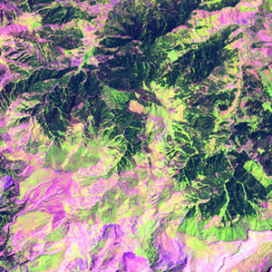
Path: 171; Row: 032
Data within tile: 100.0
|
|
Date: 1989/09/23
Cloud cover: 22.8
|
|
NDVI at image date: 82% of annual maximum
 Downolad image data [zip] Downolad image data [zip]
|
|

zoom |
|
|
Path: 172; Row: 031
Data within tile: 100.0
|
|
Date: 1987/08/16
Cloud cover: 4.1
|
|
NDVI at image date: 89% of annual maximum
Downolad image data [zip]
|
|
|
|
|
Landsat ETM+ (2000)

zoom |
|
|
Path: 171; Row: 032
Data within tile: 100.0
|
|
Date: 2000/09/05
Cloud cover: 0.0
|
|
NDVI at image date: 85% of annual maximum
Downolad image data [zip]
|
|

zoom |
|
|
Path: 172; Row: 031
Data within tile: 100.0
|
|
Date: 2000/07/10
Cloud cover: 0.0
|
|
NDVI at image date: 98% of annual maximum
Downolad image data [zip]
|
|
|
|
|
Landsat ETM+ (2005)

zoom |
|
|
Path: 171; Row: 032
Data within tile: 100.0
|
|
Date: 2006/08/05
Cloud cover: 9.4
|
|
NDVI at image date: 93% of annual maximum
Downolad image data [zip]
|
|

zoom |
|
|
Path: 172; Row: 031
Data within tile: 100.0
|
|
Date: 2007/06/28
Cloud cover: 0.2
|
|
NDVI at image date: 98% of annual maximum
Downolad image data [zip]
|
|
|