|
Landsat TM (1990)

zoom |
|
|
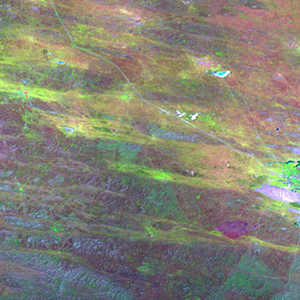
Path: 169; Row: 030
Data within tile: 100.0
|
|
Date: 1986/08/24
Cloud cover: 69.2
|
|
NDVI at image date: 79% of annual maximum
 Downolad image data [zip] Downolad image data [zip]
|
|

zoom |
|
|
Path: 170; Row: 029
Data within tile: 100.0
|
|
Date: 1988/09/13
Cloud cover: 3.8
|
|
NDVI at image date: 85% of annual maximum
Downolad image data [zip]
|
|
|
|
|
Landsat ETM+ (2000)

zoom |
|
|
Path: 169; Row: 030
Data within tile: 100.0
|
|
Date: 2001/06/22
Cloud cover: 0.0
|
|
NDVI at image date: 84% of annual maximum
Downolad image data [zip]
|
|

zoom |
|
|
Path: 169; Row: 030
Data within tile: 100.0
|
|
Date: 2001/10/12
Cloud cover: 19.3
|
|
NDVI at image date: 88% of annual maximum
Downolad image data [zip]
|
|

zoom |
|
|
Path: 170; Row: 029
Data within tile: 100.0
|
|
Date: 2001/06/13
Cloud cover: 0.0
|
|
NDVI at image date: 84% of annual maximum
Downolad image data [zip]
|
|
|
|
|
Landsat ETM+ (2005)

zoom |
|
|
Path: 169; Row: 030
Data within tile: 100.0
|
|
Date: 2007/06/23
Cloud cover: 0.0
|
|
NDVI at image date: 84% of annual maximum
Downolad image data [zip]
|
|

zoom |
|
|
Path: 170; Row: 029
Data within tile: 100.0
|
|
Date: 2005/06/08
Cloud cover: 0.0
|
|
NDVI at image date: 92% of annual maximum
Downolad image data [zip]
|
|
|