|
Landsat TM (1990)

zoom |
|
|
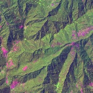
Path: 165; Row: 034
Data within tile: 100.0
|
|
Date: 1989/05/08
Cloud cover: 2.7
|
|
NDVI at image date: 95% of annual maximum
 Downolad image data [zip] Downolad image data [zip]
|
|

zoom |
|
|
Path: 166; Row: 034
Data within tile: 100.0
|
|
Date: 1989/07/02
Cloud cover: 1.6
|
|
NDVI at image date: 99% of annual maximum
Downolad image data [zip]
|
|
|
|
|
Landsat ETM+ (2000)

zoom |
|
|
Path: 165; Row: 034
Data within tile: 100.0
|
|
Date: 2000/07/25
Cloud cover: 0.0
|
|
NDVI at image date: 99% of annual maximum
Downolad image data [zip]
|
|

zoom |
|
|
Path: 166; Row: 034
Data within tile: 100.0
|
|
Date: 2000/06/30
Cloud cover: 0.0
|
|
NDVI at image date: 99% of annual maximum
Downolad image data [zip]
|
|
|
|
|
Landsat ETM+ (2005)

zoom |
|
|
Path: 165; Row: 034
Data within tile: 84.9
|
|
Date: 2006/07/10
Cloud cover: 0.0
|
|
NDVI at image date: 99% of annual maximum
Downolad image data [zip]
|
|

zoom |
|
|
Path: 166; Row: 034
Data within tile: 100.0
|
|
Date: 2005/08/15
Cloud cover: 51.4
|
|
NDVI at image date: 97% of annual maximum
Downolad image data [zip]
|
|
|