|
Landsat TM (1990)

zoom |
|
|
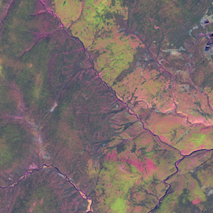
Path: 168; Row: 015
Data within tile: 100.0
|
|
Date: 1992/07/16
Cloud cover: 0.0
|
|
NDVI at image date: 100% of annual maximum
 Downolad image data [zip] Downolad image data [zip]
|
|
|
|
|
Landsat ETM+ (2000)

zoom |
|
|
Path: 167; Row: 015
Data within tile: 100.0
|
|
Date: 2000/06/05
Cloud cover: 0.0
|
|
NDVI at image date: 83% of annual maximum
Downolad image data [zip]
|
|

zoom |
|
|
Path: 168; Row: 015
Data within tile: 100.0
|
|
Date: 2001/07/17
Cloud cover: 3.0
|
|
NDVI at image date: 100% of annual maximum
Downolad image data [zip]
|
|
|
|
|
Landsat ETM+ (2005)

zoom |
|
|
Path: 168; Row: 015
Data within tile: 100.0
|
|
Date: 2005/08/29
Cloud cover: 0.0
|
|
NDVI at image date: 86% of annual maximum
Downolad image data [zip]
|
|

zoom |
|
|
Path: 167; Row: 015
Data within tile: 100.0
|
|
Date: 2006/08/17
Cloud cover: 69.4
|
|
NDVI at image date: 95% of annual maximum
Downolad image data [zip]
|
|
|