|
Landsat TM (1990)

zoom |
|
|
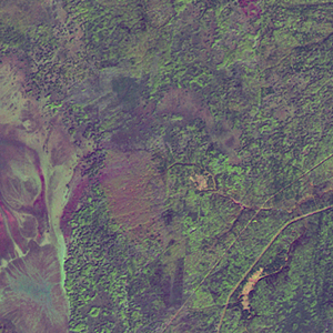
Path: 164; Row: 019
Data within tile: 100.0
|
|
Date: 1989/06/18
Cloud cover: 0.0
|
|
NDVI at image date: 98% of annual maximum
 Downolad image data [zip] Downolad image data [zip]
|
|

zoom |
|
|
Path: 165; Row: 019
Data within tile: 100.0
|
|
Date: 1988/06/22
Cloud cover: 0.0
|
|
NDVI at image date: 98% of annual maximum
Downolad image data [zip]
|
|
|
|
|
Landsat ETM+ (2000)

zoom |
|
|
Path: 164; Row: 019
Data within tile: 100.0
|
|
Date: 2000/09/04
Cloud cover: 0.0
|
|
NDVI at image date: 89% of annual maximum
Downolad image data [zip]
|
|

zoom |
|
|
Path: 165; Row: 019
Data within tile: 100.0
|
|
Date: 2002/07/31
Cloud cover: 7.4
|
|
NDVI at image date: 98% of annual maximum
Downolad image data [zip]
|
|
|
|
|
Landsat ETM+ (2005)

zoom |
|
|
Path: 164; Row: 019
Data within tile: 100.0
|
|
Date: 2007/07/14
Cloud cover: 0.0
|
|
NDVI at image date: 100% of annual maximum
Downolad image data [zip]
|
|

zoom |
|
|
Path: 165; Row: 019
Data within tile: 100.0
|
|
Date: 2006/07/18
Cloud cover: 0.0
|
|
NDVI at image date: 100% of annual maximum
Downolad image data [zip]
|
|
|