|
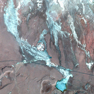
Landsat TM (1990)

zoom |
|
|
Path: 157; Row: 032
Data within tile: 100.0
|
|
Date: 1987/08/07
Cloud cover: 0.2
|
|
NDVI at image date: 68% of annual maximum
 Downolad image data [zip] Downolad image data [zip]
|
|

zoom |
|
|
Path: 157; Row: 032
Data within tile: 100.0
|
|
Date: 1992/09/21
Cloud cover: 0.1
|
|
NDVI at image date: 70% of annual maximum
Downolad image data [zip]
|
|
|
|
|
Landsat ETM+ (2000)

zoom |
|
|
Path: 157; Row: 032
Data within tile: 100.0
|
|
Date: 2001/08/21
Cloud cover: 0.0
|
|
NDVI at image date: 68% of annual maximum
Downolad image data [zip]
|
|
|
|
|
Landsat ETM+ (2005)

zoom |
|
|
Path: 157; Row: 032
Data within tile: 100.0
|
|
Date: 2006/04/13
Cloud cover: 0.0
|
|
NDVI at image date: 100% of annual maximum
Downolad image data [zip]
|
|
|