|
Landsat TM (1990)

zoom |
|
|
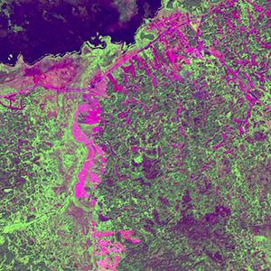
Path: 148; Row: 021
Data within tile: 98.6
|
|
Date: 1991/06/16
Cloud cover: 0.0
|
|
NDVI at image date: 100% of annual maximum
 Downolad image data [zip] Downolad image data [zip]
|
|

zoom |
|
|
Path: 149; Row: 021
Data within tile: 100.0
|
|
Date: 1989/09/05
Cloud cover: 0.0
|
|
NDVI at image date: 77% of annual maximum
Downolad image data [zip]
|
|
|
|
|
Landsat ETM+ (2000)

zoom |
|
|
Path: 148; Row: 021
Data within tile: 99.9
|
|
Date: 1999/09/18
Cloud cover: 0.0
|
|
NDVI at image date: 62% of annual maximum
Downolad image data [zip]
|
|

zoom |
|
|
Path: 149; Row: 021
Data within tile: 100.0
|
|
Date: 1999/07/07
Cloud cover: 0.0
|
|
NDVI at image date: 100% of annual maximum
Downolad image data [zip]
|
|
|
|
|
Landsat ETM+ (2005)

zoom |
|
|
Path: 149; Row: 021
Data within tile: 100.0
|
|
Date: 2007/07/13
Cloud cover: 0.0
|
|
NDVI at image date: 99% of annual maximum
Downolad image data [zip]
|
|

zoom |
|
|
Path: 148; Row: 021
Data within tile: 100.0
|
|
Date: 2007/07/14
Cloud cover: 0.0
|
|
NDVI at image date: 99% of annual maximum
Downolad image data [zip]
|
|
|