|
Landsat TM (1990)

zoom |
|
|
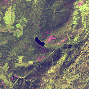
Path: 145; Row: 024
Data within tile: 100.0
|
|
Date: 1993/05/31
Cloud cover: 2.3
|
|
NDVI at image date: 92% of annual maximum
 Downolad image data [zip] Downolad image data [zip]
|
|
|
|
|
Landsat ETM+ (2000)

zoom |
|
|
Path: 144; Row: 024
Data within tile: 100.0
|
|
Date: 2001/09/27
Cloud cover: 0.0
|
|
NDVI at image date: 86% of annual maximum
Downolad image data [zip]
|
|

zoom |
|
|
Path: 145; Row: 024
Data within tile: 100.0
|
|
Date: 2001/08/17
Cloud cover: 0.0
|
|
NDVI at image date: 96% of annual maximum
Downolad image data [zip]
|
|
|
|
|
Landsat ETM+ (2005)

zoom |
|
|
Path: 144; Row: 024
Data within tile: 100.0
|
|
Date: 2006/09/17
Cloud cover: 0.0
|
|
NDVI at image date: 86% of annual maximum
Downolad image data [zip]
|
|

zoom |
|
|
Path: 145; Row: 024
Data within tile: 100.0
|
|
Date: 2006/09/08
Cloud cover: 0.0
|
|
NDVI at image date: 91% of annual maximum
Downolad image data [zip]
|
|
|