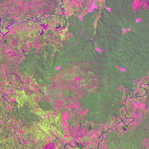
Global Forest Resources Assessment

Food and Agriculture Organization of the UN
GIScCE, South Dakota State University


e100n01


Location


1° N; 100° E
Asia; Indonesia (Sumatera Utara)
Elevation of the tile center point: 133 m
Water consist 0.0% of block area


Biome/ecoregion


Tropical & Subtropical Moist Broadleaf Forests biome
Sumatran lowland rain forests ecoregion


External information resources


The Degree Confluence Project information


Tile outlines


 Tile outline 10x10km and 20x20km [KMZ]
 Tile outline 10x10km [SHP]
 Tile outline 20x20km [SHP]


Landsat TM (1990)


     zoom

Path: 128; Row: 059


Data within tile: 100.0


Date: 1994/07/14


Cloud cover: 17.7


NDVI at image date: 98% of annual maximum


 Downolad image data [zip]


Landsat ETM+ (2000)


     zoom

Path: 128; Row: 059


Data within tile: 100.0


Date: 2001/07/09


Cloud cover: 0.0


NDVI at image date: 99% of annual maximum


 Downolad image data [zip]


Landsat ETM+ (2005)