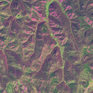
Global Forest Resources Assessment

Food and Agriculture Organization of the UN
GIScCE, South Dakota State University


e103n49


Location


49° N; 103° E
Asia; Mongolia (Bulgan)
Elevation of the tile center point: 1668 m
Water consist 0.0% of block area


Biome/ecoregion


Temperate Grasslands, Savannas & Shrublands biome
Selenge-Orkhon forest steppe ecoregion


External information resources


The Degree Confluence Project information


Tile outlines


 Tile outline 10x10km and 20x20km [KMZ]
 Tile outline 10x10km [SHP]
 Tile outline 20x20km [SHP]


Landsat TM (1990)


     zoom

Path: 134; Row: 026


Data within tile: 100.0


Date: 1989/08/19


Cloud cover: 31.9


NDVI at image date: 92% of annual maximum


 Downolad image data [zip]


     zoom

Path: 134; Row: 026


Data within tile: 100.0


Date: 1991/08/17


Cloud cover: 0.0


NDVI at image date: 92% of annual maximum


 Downolad image data [zip]


Landsat ETM+ (2000)


     zoom

Path: 134; Row: 026


Data within tile: 100.0


Date: 2001/08/20


Cloud cover: 0.0


NDVI at image date: 92% of annual maximum


 Downolad image data [zip]


Landsat ETM+ (2005)