|
Landsat TM (1990)

zoom |
|
|
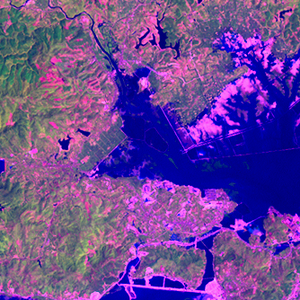
Path: 126; Row: 045
Data within tile: 100.0
|
|
Date: 1991/10/28
Cloud cover: 0.5
|
|
NDVI at image date: 97% of annual maximum
 Downolad image data [zip] Downolad image data [zip]
|
|
|
|
|
Landsat ETM+ (2000)

zoom |
|
|
Path: 126; Row: 045
Data within tile: 100.0
|
|
Date: 1999/09/24
Cloud cover: 67.2
|
|
NDVI at image date: 100% of annual maximum
Downolad image data [zip]
|
|

zoom |
|
|
Path: 126; Row: 045
Data within tile: 100.0
|
|
Date: 2001/09/29
Cloud cover: 0.0
|
|
NDVI at image date: 100% of annual maximum
Downolad image data [zip]
|
|
|
|
|
Landsat ETM+ (2005)

zoom |
|
|
Path: 126; Row: 045
Data within tile: 100.0
|
|
Date: 2004/12/02
Cloud cover: 2.1
|
|
NDVI at image date: 85% of annual maximum
Downolad image data [zip]
|
|
|