|
Landsat TM (1990)

zoom |
|
|
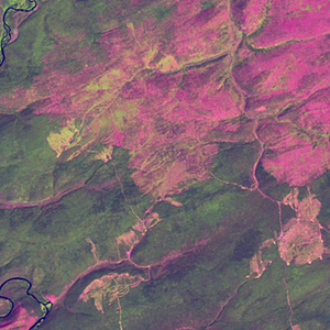
Path: 131; Row: 018
Data within tile: 100.0
|
|
Date: 1993/09/02
Cloud cover: 0.0
|
|
NDVI at image date: 85% of annual maximum
 Downolad image data [zip] Downolad image data [zip]
|
|
|
|
|
Landsat ETM+ (2000)

zoom |
|
|
Path: 130; Row: 018
Data within tile: 100.0
|
|
Date: 2000/06/18
Cloud cover: 0.0
|
|
NDVI at image date: 99% of annual maximum
Downolad image data [zip]
|
|

zoom |
|
|
Path: 131; Row: 018
Data within tile: 100.0
|
|
Date: 2000/08/28
Cloud cover: 0.0
|
|
NDVI at image date: 85% of annual maximum
Downolad image data [zip]
|
|
|
|
|
Landsat ETM+ (2005)

zoom |
|
|
Path: 131; Row: 018
Data within tile: 100.0
|
|
Date: 2004/07/06
Cloud cover: 0.2
|
|
NDVI at image date: 99% of annual maximum
Downolad image data [zip]
|
|

zoom |
|
|
Path: 130; Row: 018
Data within tile: 100.0
|
|
Date: 2007/08/01
Cloud cover: 0.0
|
|
NDVI at image date: 99% of annual maximum
Downolad image data [zip]
|
|
|