|
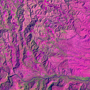
Landsat TM (1990)

zoom |
|
|
Path: 112; Row: 056
Data within tile: 100.0
|
|
Date: 1989/12/31
Cloud cover: 0.5
|
|
NDVI at image date: 99% of annual maximum
 Downolad image data [zip] Downolad image data [zip]
|
|
|
|
|
Landsat ETM+ (2000)

zoom |
|
|
Path: 112; Row: 056
Data within tile: 100.0
|
|
Date: 2000/02/13
Cloud cover: 0.0
|
|
NDVI at image date: 89% of annual maximum
Downolad image data [zip]
|
|
|
|
|
Landsat ETM+ (2005)

zoom |
|
|
Path: 112; Row: 056
Data within tile: 89.2
|
|
Date: 2007/04/05
Cloud cover: 0.1
|
|
NDVI at image date: 82% of annual maximum
Downolad image data [zip]
|
|

zoom |
|
|
Path: 112; Row: 056
Data within tile: 88.9
|
|
Date: 2007/10/30
Cloud cover: 7.7
|
|
NDVI at image date: 98% of annual maximum
Downolad image data [zip]
|
|
|