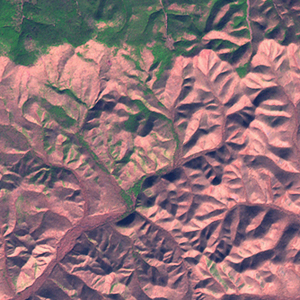
Global Forest Resources Assessment

Food and Agriculture Organization of the UN
GIScCE, South Dakota State University


e135n44


Location


44° N; 135° E
Europe; Russian Federation (Primorskiy Kray)
Elevation of the tile center point: 486 m
Water consist 0.0% of block area


Biome/ecoregion


Temperate Broadleaf & Mixed Forests biome
Ussuri broadleaf and mixed forests ecoregion


External information resources


The Degree Confluence Project information


Tile outlines


 Tile outline 10x10km and 20x20km [KMZ]
 Tile outline 10x10km [SHP]
 Tile outline 20x20km [SHP]


Landsat TM (1990)


     zoom

Path: 112; Row: 029


Data within tile: 100.0


Date: 1987/10/15


Cloud cover: 51.0


NDVI at image date: 70% of annual maximum


 Downolad image data [zip]


Landsat ETM+ (2000)


     zoom

Path: 112; Row: 029


Data within tile: 100.0


Date: 2001/06/23


Cloud cover: 0.0


NDVI at image date: 64% of annual maximum


 Downolad image data [zip]


     zoom

Path: 112; Row: 029


Data within tile: 100.0


Date: 2001/10/29


Cloud cover: 0.0


NDVI at image date: 49% of annual maximum


 Downolad image data [zip]


Landsat ETM+ (2005)