|
Landsat TM (1990)

zoom |
|
|
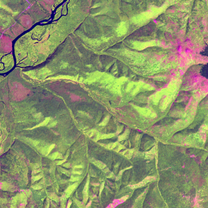
Path: 110; Row: 025
Data within tile: 100.0
|
|
Date: 1989/06/16
Cloud cover: 0.1
|
|
NDVI at image date: 92% of annual maximum
 Downolad image data [zip] Downolad image data [zip]
|
|

zoom |
|
|
Path: 111; Row: 025
Data within tile: 87.1
|
|
Date: 1990/08/13
Cloud cover: 0.0
|
|
NDVI at image date: 98% of annual maximum
Downolad image data [zip]
|
|
|
|
|
Landsat ETM+ (2000)

zoom |
|
|
Path: 110; Row: 025
Data within tile: 100.0
|
|
Date: 2000/06/22
Cloud cover: 0.0
|
|
NDVI at image date: 92% of annual maximum
Downolad image data [zip]
|
|

zoom |
|
|
Path: 111; Row: 025
Data within tile: 77.8
|
|
Date: 2002/05/18
Cloud cover: 15.3
|
|
NDVI at image date: 77% of annual maximum
Downolad image data [zip]
|
|
|
|
|
Landsat ETM+ (2005)

zoom |
|
|
Path: 110; Row: 025
Data within tile: 100.0
|
|
Date: 2006/10/13
Cloud cover: 0.0
|
|
NDVI at image date: 67% of annual maximum
Downolad image data [zip]
|
|

zoom |
|
|
Path: 111; Row: 025
Data within tile: 90.8
|
|
Date: 2007/06/01
Cloud cover: 0.0
|
|
NDVI at image date: 82% of annual maximum
Downolad image data [zip]
|
|
|