|
Landsat TM (1990)

zoom |
|
|
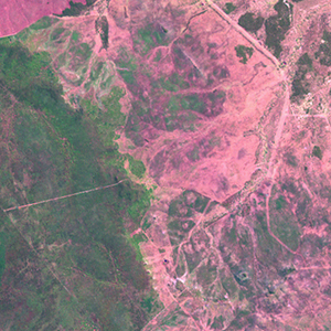
Path: 093; Row: 077
Data within tile: 100.0
|
|
Date: 1990/03/07
Cloud cover: 0.0
|
|
NDVI at image date: 95% of annual maximum
 Downolad image data [zip] Downolad image data [zip]
|
|

zoom |
|
|
Path: 094; Row: 077
Data within tile: 100.0
|
|
Date: 1990/08/05
Cloud cover: 0.0
|
|
NDVI at image date: 90% of annual maximum
Downolad image data [zip]
|
|
|
|
|
Landsat ETM+ (2000)

zoom |
|
|
Path: 093; Row: 077
Data within tile: 100.0
|
|
Date: 2001/08/20
Cloud cover: 1.5
|
|
NDVI at image date: 87% of annual maximum
Downolad image data [zip]
|
|

zoom |
|
|
Path: 094; Row: 077
Data within tile: 100.0
|
|
Date: 2000/08/25
Cloud cover: 0.0
|
|
NDVI at image date: 87% of annual maximum
Downolad image data [zip]
|
|
|
|
|
Landsat ETM+ (2005)

zoom |
|
|
Path: 093; Row: 077
Data within tile: 97.4
|
|
Date: 2006/08/02
Cloud cover: 0.0
|
|
NDVI at image date: 90% of annual maximum
Downolad image data [zip]
|
|

zoom |
|
|
Path: 094; Row: 077
Data within tile: 99.8
|
|
Date: 2006/07/09
Cloud cover: 0.0
|
|
NDVI at image date: 96% of annual maximum
Downolad image data [zip]
|
|
|