|
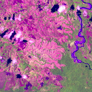
Landsat TM (1990)

zoom |
|
|
Path: 095; Row: 067
Data within tile: 100.0
|
|
Date: 1991/12/05
Cloud cover: 0.0
|
|
NDVI at image date: 98% of annual maximum
 Downolad image data [zip] Downolad image data [zip]
|
|
|
|
|
Landsat ETM+ (2000)

zoom |
|
|
Path: 095; Row: 067
Data within tile: 100.0
|
|
Date: 2001/10/22
Cloud cover: 2.2
|
|
NDVI at image date: 96% of annual maximum
Downolad image data [zip]
|
|
|
|
|
Landsat ETM+ (2005)

zoom |
|
|
Path: 095; Row: 067
Data within tile: 98.8
|
|
Date: 2005/06/11
Cloud cover: 0.0
|
|
NDVI at image date: 99% of annual maximum
Downolad image data [zip]
|
|

zoom |
|
|
Path: 095; Row: 067
Data within tile: 100.0
|
|
Date: 2006/02/06
Cloud cover: 13.0
|
|
NDVI at image date: 93% of annual maximum
Downolad image data [zip]
|
|
|