|
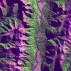
Landsat TM (1990)

zoom |
|
|
Path: 076; Row: 091
Data within tile: 100.0
|
|
Date: 1988/11/13
Cloud cover: 42.3
|
|
NDVI at image date: 86% of annual maximum
 Downolad image data [zip] Downolad image data [zip]
|
|

zoom |
|
|
Path: 076; Row: 091
Data within tile: 100.0
|
|
Date: 1990/12/21
Cloud cover: 34.2
|
|
NDVI at image date: 99% of annual maximum
Downolad image data [zip]
|
|
|
|
|
Landsat ETM+ (2000)

zoom |
|
|
Path: 076; Row: 091
Data within tile: 100.0
|
|
Date: 2001/04/07
Cloud cover: 0.8
|
|
NDVI at image date: 100% of annual maximum
Downolad image data [zip]
|
|
|
|
|
Landsat ETM+ (2005)

zoom |
|
|
Path: 076; Row: 091
Data within tile: 96.6
|
|
Date: 2005/11/28
Cloud cover: 2.6
|
|
NDVI at image date: 90% of annual maximum
Downolad image data [zip]
|
|

zoom |
|
|
Path: 076; Row: 091
Data within tile: 95.6
|
|
Date: 2006/02/16
Cloud cover: 1.2
|
|
NDVI at image date: 99% of annual maximum
Downolad image data [zip]
|
|
|