|
Landsat TM (1990)

zoom |
|
|
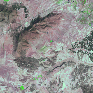
Path: 199; Row: 034
Data within tile: 100.0
|
|
Date: 1987/06/26
Cloud cover: 0.8
|
|
NDVI at image date: 66% of annual maximum
 Downolad image data [zip] Downolad image data [zip]
|
|

zoom |
|
|
Path: 199; Row: 034
Data within tile: 100.0
|
|
Date: 1992/04/20
Cloud cover: 47.6
|
|
NDVI at image date: 100% of annual maximum
Downolad image data [zip]
|
|

zoom |
|
|
Path: 200; Row: 034
Data within tile: 100.0
|
|
Date: 1987/04/14
Cloud cover: 61.3
|
|
NDVI at image date: 100% of annual maximum
Downolad image data [zip]
|
|
|
|
|
Landsat ETM+ (2000)

zoom |
|
|
Path: 199; Row: 034
Data within tile: 100.0
|
|
Date: 2000/08/08
Cloud cover: 0.1
|
|
NDVI at image date: 64% of annual maximum
Downolad image data [zip]
|
|

zoom |
|
|
Path: 199; Row: 034
Data within tile: 100.0
|
|
Date: 2001/12/01
Cloud cover: 0.4
|
|
NDVI at image date: 80% of annual maximum
Downolad image data [zip]
|
|

zoom |
|
|
Path: 200; Row: 034
Data within tile: 84.8
|
|
Date: 2000/04/25
Cloud cover: 1.4
|
|
NDVI at image date: 97% of annual maximum
Downolad image data [zip]
|
|
|
|
|
Landsat ETM+ (2005)

zoom |
|
|
Path: 199; Row: 034
Data within tile: 100.0
|
|
Date: 2005/05/18
Cloud cover: 0.1
|
|
NDVI at image date: 94% of annual maximum
Downolad image data [zip]
|
|

zoom |
|
|
Path: 200; Row: 034
Data within tile: 92.7
|
|
Date: 2005/05/25
Cloud cover: 0.1
|
|
NDVI at image date: 81% of annual maximum
Downolad image data [zip]
|
|
|