|
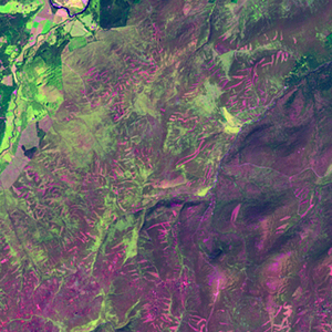
Landsat TM (1990)

zoom |
|
|
Path: 205; Row: 020
Data within tile: 100.0
|
|
Date: 1995/06/26
Cloud cover: 0.0
|
|
NDVI at image date: 96% of annual maximum
 Downolad image data [zip] Downolad image data [zip]
|
|
|
|
|
Landsat ETM+ (2000)

zoom |
|
|
Path: 204; Row: 020
Data within tile: 100.0
|
|
Date: 2001/05/10
Cloud cover: 10.5
|
|
NDVI at image date: 89% of annual maximum
Downolad image data [zip]
|
|

zoom |
|
|
Path: 205; Row: 020
Data within tile: 100.0
|
|
Date: 2000/07/17
Cloud cover: 0.0
|
|
NDVI at image date: 100% of annual maximum
Downolad image data [zip]
|
|
|
|
|
Landsat ETM+ (2005)

zoom |
|
|
Path: 204; Row: 020
Data within tile: 59.2
|
|
Date: 2007/10/02
Cloud cover: 0.0
|
|
NDVI at image date: 98% of annual maximum
Downolad image data [zip]
|
|

zoom |
|
|
Path: 205; Row: 020
Data within tile: 99.9
|
|
Date: 2007/08/22
Cloud cover: 2.1
|
|
NDVI at image date: 100% of annual maximum
Downolad image data [zip]
|
|

zoom |
|
|
Path: 205; Row: 020
Data within tile: 100.0
|
|
Date: 2007/10/25
Cloud cover: 0.0
|
|
NDVI at image date: 96% of annual maximum
Downolad image data [zip]
|
|
|