|
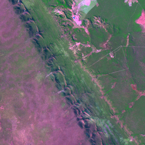
Landsat TM (1990)

zoom |
|
|
Path: 219; Row: 068
Data within tile: 100.0
|
|
Date: 1990/08/17
Cloud cover: 0.0
|
|
NDVI at image date: 52% of annual maximum
 Downolad image data [zip] Downolad image data [zip]
|
|
|
|
|
Landsat ETM+ (2000)

zoom |
|
|
Path: 219; Row: 068
Data within tile: 100.0
|
|
Date: 2000/08/20
Cloud cover: 0.0
|
|
NDVI at image date: 52% of annual maximum
Downolad image data [zip]
|
|
|
|
|
Landsat ETM+ (2005)

zoom |
|
|
Path: 219; Row: 068
Data within tile: 100.0
|
|
Date: 2006/12/03
Cloud cover: 0.0
|
|
NDVI at image date: 90% of annual maximum
Downolad image data [zip]
|
|
|