|
Landsat TM (1990)

zoom |
|
|
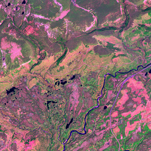
Path: 005; Row: 027
Data within tile: 100.0
|
|
Date: 1991/08/09
Cloud cover: 0.0
|
|
NDVI at image date: 99% of annual maximum
 Downolad image data [zip] Downolad image data [zip]
|
|

zoom |
|
|
Path: 006; Row: 027
Data within tile: 100.0
|
|
Date: 1987/07/20
Cloud cover: 68.7
|
|
NDVI at image date: 99% of annual maximum
Downolad image data [zip]
|
|
|
|
|
Landsat ETM+ (2000)

zoom |
|
|
Path: 005; Row: 027
Data within tile: 100.0
|
|
Date: 2000/06/06
Cloud cover: 0.5
|
|
NDVI at image date: 85% of annual maximum
Downolad image data [zip]
|
|

zoom |
|
|
Path: 006; Row: 027
Data within tile: 100.0
|
|
Date: 2002/06/19
Cloud cover: 1.2
|
|
NDVI at image date: 93% of annual maximum
Downolad image data [zip]
|
|
|
|
|
Landsat ETM+ (2005)

zoom |
|
|
Path: 005; Row: 027
Data within tile: 100.0
|
|
Date: 2005/07/22
Cloud cover: 0.0
|
|
NDVI at image date: 99% of annual maximum
Downolad image data [zip]
|
|

zoom |
|
|
Path: 006; Row: 027
Data within tile: 100.0
|
|
Date: 2004/08/11
Cloud cover: 0.0
|
|
NDVI at image date: 99% of annual maximum
Downolad image data [zip]
|
|
|