|
Landsat TM (1990)

zoom |
|
|
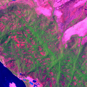
Path: 003; Row: 055
Data within tile: 81.4
|
|
Date: 1988/03/19
Cloud cover: 70.3
|
|
NDVI at image date: 70% of annual maximum
 Downolad image data [zip] Downolad image data [zip]
|
|

zoom |
|
|
Path: 004; Row: 055
Data within tile: 100.0
|
|
Date: 1988/03/26
Cloud cover: 0.9
|
|
NDVI at image date: 70% of annual maximum
Downolad image data [zip]
|
|
|
|
|
Landsat ETM+ (2000)

zoom |
|
|
Path: 003; Row: 055
Data within tile: 100.0
|
|
Date: 2001/03/07
Cloud cover: 0.0
|
|
NDVI at image date: 70% of annual maximum
Downolad image data [zip]
|
|

zoom |
|
|
Path: 004; Row: 055
Data within tile: 100.0
|
|
Date: 2001/03/14
Cloud cover: 0.0
|
|
NDVI at image date: 70% of annual maximum
Downolad image data [zip]
|
|
|
|
|
Landsat ETM+ (2005)

zoom |
|
|
Path: 003; Row: 055
Data within tile: 58.7
|
|
Date: 2004/03/15
Cloud cover: 1.3
|
|
NDVI at image date: 70% of annual maximum
Downolad image data [zip]
|
|

zoom |
|
|
Path: 003; Row: 055
Data within tile: 58.5
|
|
Date: 2004/09/23
Cloud cover: 0.1
|
|
NDVI at image date: 99% of annual maximum
Downolad image data [zip]
|
|

zoom |
|
|
Path: 004; Row: 055
Data within tile: 89.5
|
|
Date: 2007/01/10
Cloud cover: 0.9
|
|
NDVI at image date: 89% of annual maximum
Downolad image data [zip]
|
|
|