|
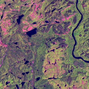
Landsat TM (1990)

zoom |
|
|
Path: 012; Row: 026
Data within tile: 100.0
|
|
Date: 1986/07/27
Cloud cover: 0.1
|
|
NDVI at image date: 100% of annual maximum
 Downolad image data [zip] Downolad image data [zip]
|
|
|
|
|
Landsat ETM+ (2000)

zoom |
|
|
Path: 012; Row: 026
Data within tile: 100.0
|
|
Date: 2002/06/13
Cloud cover: 0.0
|
|
NDVI at image date: 95% of annual maximum
Downolad image data [zip]
|
|
|
|
|
Landsat ETM+ (2005)

zoom |
|
|
Path: 012; Row: 026
Data within tile: 100.0
|
|
Date: 2005/07/07
Cloud cover: 0.0
|
|
NDVI at image date: 97% of annual maximum
Downolad image data [zip]
|
|
|