|
Landsat TM (1990)

zoom |
|
|
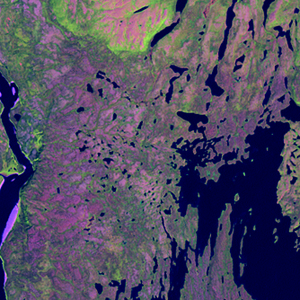
Path: 014; Row: 020
Data within tile: 100.0
|
|
Date: 1985/08/23
Cloud cover: 0.1
|
|
NDVI at image date: 100% of annual maximum
 Downolad image data [zip] Downolad image data [zip]
|
|

zoom |
|
|
Path: 015; Row: 020
Data within tile: 100.0
|
|
Date: 1991/07/30
Cloud cover: 0.1
|
|
NDVI at image date: 98% of annual maximum
Downolad image data [zip]
|
|
|
|
|
Landsat ETM+ (2000)

zoom |
|
|
Path: 014; Row: 020
Data within tile: 100.0
|
|
Date: 2000/08/24
Cloud cover: 0.2
|
|
NDVI at image date: 100% of annual maximum
Downolad image data [zip]
|
|

zoom |
|
|
Path: 015; Row: 020
Data within tile: 100.0
|
|
Date: 2001/07/17
Cloud cover: 0.0
|
|
NDVI at image date: 97% of annual maximum
Downolad image data [zip]
|
|
|
|
|
Landsat ETM+ (2005)

zoom |
|
|
Path: 015; Row: 020
Data within tile: 81.2
|
|
Date: 2004/07/09
Cloud cover: 0.7
|
|
NDVI at image date: 91% of annual maximum
Downolad image data [zip]
|
|

zoom |
|
|
Path: 015; Row: 020
Data within tile: 81.8
|
|
Date: 2005/06/10
Cloud cover: 0.1
|
|
NDVI at image date: 85% of annual maximum
Downolad image data [zip]
|
|
|