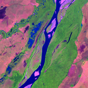
Global Forest Resources Assessment

Food and Agriculture Organization of the UN
GIScCE, South Dakota State University


w071n05


Location


5° N; 71° W
Americas; Colombia (Casanare)
Elevation of the tile center point: 128 m
Water consist 6.4% of block area


Biome/ecoregion


Tropical & Subtropical Grasslands, Savannas & Shrublands biome
Llanos ecoregion


External information resources


The Degree Confluence Project information


Tile outlines


 Tile outline 10x10km and 20x20km [KMZ]
 Tile outline 10x10km [SHP]
 Tile outline 20x20km [SHP]


Landsat TM (1990)


     zoom

Path: 006; Row: 057


Data within tile: 98.6


Date: 1988/01/04


Cloud cover: 3.1


NDVI at image date: 91% of annual maximum


 Downolad image data [zip]


Landsat ETM+ (2000)


     zoom

Path: 006; Row: 057


Data within tile: 100.0


Date: 2000/01/05


Cloud cover: 0.2


NDVI at image date: 91% of annual maximum


 Downolad image data [zip]


Landsat ETM+ (2005)


     zoom

Path: 006; Row: 057


Data within tile: 100.0


Date: 2006/04/11


Cloud cover: 0.0


NDVI at image date: 87% of annual maximum


 Downolad image data [zip]