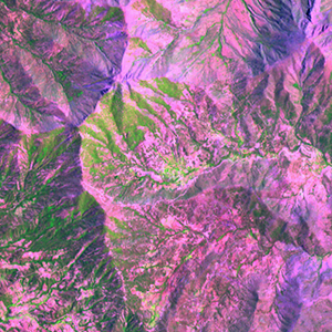
Global Forest Resources Assessment

Food and Agriculture Organization of the UN
GIScCE, South Dakota State University


w071s33


Location


33° S; 71° W
Americas; Chile (Metropolitana (xiii))
Elevation of the tile center point: 1102 m
Water consist 0.0% of block area


Biome/ecoregion


Temperate Broadleaf & Mixed Forests biome
Valdivian temperate forests ecoregion


External information resources


The Degree Confluence Project information


Tile outlines


 Tile outline 10x10km and 20x20km [KMZ]
 Tile outline 10x10km [SHP]
 Tile outline 20x20km [SHP]


Landsat TM (1990)


     zoom

Path: 233; Row: 083


Data within tile: 100.0


Date: 1989/03/17


Cloud cover: 7.0


NDVI at image date: 74% of annual maximum


 Downolad image data [zip]


Landsat ETM+ (2000)


     zoom

Path: 233; Row: 083


Data within tile: 100.0


Date: 1999/12/26


Cloud cover: 0.0


NDVI at image date: 77% of annual maximum


 Downolad image data [zip]


Landsat ETM+ (2005)