|
Landsat TM (1990)

zoom |
|
|
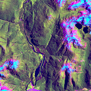
Path: 232; Row: 089
Data within tile: 100.0
|
|
Date: 1987/02/09
Cloud cover: 5.9
|
|
NDVI at image date: 99% of annual maximum
 Downolad image data [zip] Downolad image data [zip]
|
|

zoom |
|
|
Path: 233; Row: 088
Data within tile: 100.0
|
|
Date: 1986/09/25
Cloud cover: 4.9
|
|
NDVI at image date: 70% of annual maximum
Downolad image data [zip]
|
|
|
|
|
Landsat ETM+ (2000)

zoom |
|
|
Path: 232; Row: 089
Data within tile: 100.0
|
|
Date: 2001/12/08
Cloud cover: 13.5
|
|
NDVI at image date: 96% of annual maximum
Downolad image data [zip]
|
|

zoom |
|
|
Path: 233; Row: 088
Data within tile: 96.8
|
|
Date: 2001/11/29
Cloud cover: 16.2
|
|
NDVI at image date: 92% of annual maximum
Downolad image data [zip]
|
|
|
|
|
Landsat ETM+ (2005)

zoom |
|
|
Path: 232; Row: 089
Data within tile: 100.0
|
|
Date: 2007/01/07
Cloud cover: 7.1
|
|
NDVI at image date: 100% of annual maximum
Downolad image data [zip]
|
|

zoom |
|
|
Path: 233; Row: 088
Data within tile: 98.7
|
|
Date: 2005/02/09
Cloud cover: 2.2
|
|
NDVI at image date: 99% of annual maximum
Downolad image data [zip]
|
|
|