|
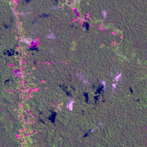
Landsat TM (1990)

zoom |
|
|
Path: 007; Row: 066
Data within tile: 93.0
|
|
Date: 1986/11/13
Cloud cover: 0.1
|
|
NDVI at image date: 93% of annual maximum
 Downolad image data [zip] Downolad image data [zip]
|
|
|
|
|
Landsat ETM+ (2000)

zoom |
|
|
Path: 006; Row: 066
Data within tile: 100.0
|
|
Date: 2000/09/01
Cloud cover: 0.3
|
|
NDVI at image date: 100% of annual maximum
Downolad image data [zip]
|
|

zoom |
|
|
Path: 007; Row: 066
Data within tile: 99.8
|
|
Date: 2001/08/26
Cloud cover: 0.0
|
|
NDVI at image date: 100% of annual maximum
Downolad image data [zip]
|
|
|
|
|
Landsat ETM+ (2005)

zoom |
|
|
Path: 006; Row: 066
Data within tile: 100.0
|
|
Date: 2004/08/03
Cloud cover: 0.0
|
|
NDVI at image date: 100% of annual maximum
Downolad image data [zip]
|
|

zoom |
|
|
Path: 007; Row: 066
Data within tile: 100.0
|
|
Date: 2004/01/31
Cloud cover: 2.1
|
|
NDVI at image date: 87% of annual maximum
Downolad image data [zip]
|
|
|