|
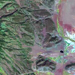
Landsat TM (1990)

zoom |
|
|
Path: 034; Row: 033
Data within tile: 100.0
|
|
Date: 1989/07/05
Cloud cover: 1.5
|
|
NDVI at image date: 94% of annual maximum
 Downolad image data [zip] Downolad image data [zip]
|
|
|
|
|
Landsat ETM+ (2000)

zoom |
|
|
Path: 034; Row: 033
Data within tile: 100.0
|
|
Date: 2001/09/24
Cloud cover: 0.1
|
|
NDVI at image date: 83% of annual maximum
Downolad image data [zip]
|
|
|
|
|
Landsat ETM+ (2005)

zoom |
|
|
Path: 034; Row: 033
Data within tile: 100.0
|
|
Date: 2007/09/25
Cloud cover: 0.5
|
|
NDVI at image date: 83% of annual maximum
Downolad image data [zip]
|
|
|