|
Landsat TM (1990)

zoom |
|
|
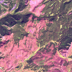
Path: 038; Row: 029
Data within tile: 100.0
|
|
Date: 1990/09/14
Cloud cover: 0.0
|
|
NDVI at image date: 90% of annual maximum
 Downolad image data [zip] Downolad image data [zip]
|
|

zoom |
|
|
Path: 039; Row: 029
Data within tile: 100.0
|
|
Date: 1987/06/25
Cloud cover: 0.2
|
|
NDVI at image date: 97% of annual maximum
Downolad image data [zip]
|
|
|
|
|
Landsat ETM+ (2000)

zoom |
|
|
Path: 038; Row: 029
Data within tile: 100.0
|
|
Date: 1999/09/15
Cloud cover: 0.0
|
|
NDVI at image date: 90% of annual maximum
Downolad image data [zip]
|
|

zoom |
|
|
Path: 039; Row: 029
Data within tile: 100.0
|
|
Date: 2001/08/26
Cloud cover: 0.0
|
|
NDVI at image date: 96% of annual maximum
Downolad image data [zip]
|
|
|
|
|
Landsat ETM+ (2005)

zoom |
|
|
Path: 039; Row: 029
Data within tile: 95.4
|
|
Date: 2006/08/24
Cloud cover: 12.3
|
|
NDVI at image date: 96% of annual maximum
Downolad image data [zip]
|
|

zoom |
|
|
Path: 038; Row: 029
Data within tile: 100.0
|
|
Date: 2005/07/21
Cloud cover: 0.0
|
|
NDVI at image date: 100% of annual maximum
Downolad image data [zip]
|
|
|