|
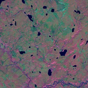
Landsat TM (1990)

zoom |
|
|
Path: 045; Row: 019
Data within tile: 100.0
|
|
Date: 1990/09/15
Cloud cover: 0.0
|
|
NDVI at image date: 83% of annual maximum
 Downolad image data [zip] Downolad image data [zip]
|
|
|
|
|
Landsat ETM+ (2000)

zoom |
|
|
Path: 045; Row: 019
Data within tile: 100.0
|
|
Date: 2000/05/29
Cloud cover: 0.0
|
|
NDVI at image date: 84% of annual maximum
Downolad image data [zip]
|
|

zoom |
|
|
Path: 046; Row: 019
Data within tile: 100.0
|
|
Date: 2002/06/11
Cloud cover: 0.0
|
|
NDVI at image date: 91% of annual maximum
Downolad image data [zip]
|
|
|
|
|
Landsat ETM+ (2005)

zoom |
|
|
Path: 045; Row: 019
Data within tile: 99.9
|
|
Date: 2004/06/25
Cloud cover: 0.0
|
|
NDVI at image date: 96% of annual maximum
Downolad image data [zip]
|
|

zoom |
|
|
Path: 046; Row: 019
Data within tile: 100.0
|
|
Date: 2006/09/02
Cloud cover: 0.0
|
|
NDVI at image date: 88% of annual maximum
Downolad image data [zip]
|
|
|