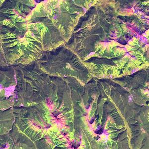
Global Forest Resources Assessment

Food and Agriculture Organization of the UN
GIScCE, South Dakota State University


w126n58


Location


58° N; 126° W
Americas; Canada (British Columbia)
Elevation of the tile center point: 1547 m
Water consist 0.0% of block area


Biome/ecoregion


Boreal Forests/Taiga biome
Northern Cordillera forests ecoregion


External information resources


The Degree Confluence Project information


Tile outlines


 Tile outline 10x10km and 20x20km [KMZ]
 Tile outline 10x10km [SHP]
 Tile outline 20x20km [SHP]


Landsat TM (1990)


     zoom

Path: 051; Row: 020


Data within tile: 100.0


Date: 1988/09/03


Cloud cover: 0.0


NDVI at image date: 84% of annual maximum


 Downolad image data [zip]


Landsat ETM+ (2000)


     zoom

Path: 051; Row: 020


Data within tile: 100.0


Date: 2001/08/14


Cloud cover: 0.3


NDVI at image date: 95% of annual maximum


 Downolad image data [zip]


Landsat ETM+ (2005)