|
Landsat TM (1990)

zoom |
|
|
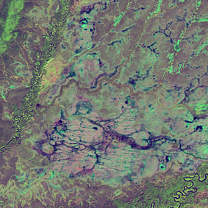
Path: 072; Row: 017
Data within tile: 100.0
|
|
Date: 1991/08/30
Cloud cover: 0.2
|
|
NDVI at image date: 91% of annual maximum
 Downolad image data [zip] Downolad image data [zip]
|
|

zoom |
|
|
Path: 074; Row: 016
Data within tile: 100.0
|
|
Date: 1986/05/26
Cloud cover: 0.1
|
|
NDVI at image date: 92% of annual maximum
Downolad image data [zip]
|
|
|
|
|
Landsat ETM+ (2000)

zoom |
|
|
Path: 072; Row: 017
Data within tile: 100.0
|
|
Date: 1999/08/28
Cloud cover: 0.0
|
|
NDVI at image date: 95% of annual maximum
Downolad image data [zip]
|
|

zoom |
|
|
Path: 074; Row: 016
Data within tile: 100.0
|
|
Date: 2002/06/15
Cloud cover: 0.0
|
|
NDVI at image date: 98% of annual maximum
Downolad image data [zip]
|
|
|
|
|
Landsat ETM+ (2005)

zoom |
|
|
Path: 072; Row: 017
Data within tile: 60.8
|
|
Date: 2005/07/11
Cloud cover: 1.4
|
|
NDVI at image date: 98% of annual maximum
Downolad image data [zip]
|
|

zoom |
|
|
Path: 072; Row: 017
Data within tile: 61.1
|
|
Date: 2005/08/12
Cloud cover: 9.1
|
|
NDVI at image date: 97% of annual maximum
Downolad image data [zip]
|
|

zoom |
|
|
Path: 074; Row: 016
Data within tile: 100.0
|
|
Date: 2006/07/04
Cloud cover: 0.0
|
|
NDVI at image date: 98% of annual maximum
Downolad image data [zip]
|
|
|