Principal Investigator:
CO Investigators:
Sponsor:
Time period:
Researchers:
Project Description:
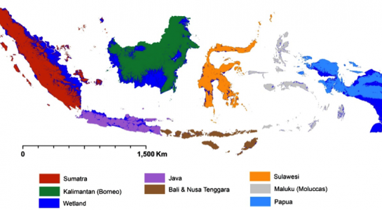
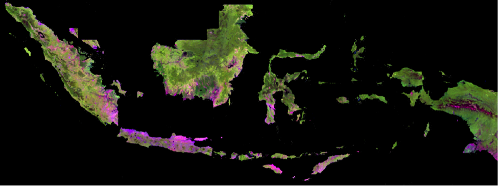
In order to develop a set of comprehensive data, including exhaustive data on deforestation from 1990s or beyond up to recently, and within the frame of the Indonesian One Map Movement, the Government of Indonesia (GOI) is seeking a credible and exhaustive monitoring system generated from year 1980s, under technical collaboration with the University of Maryland. The University of Maryland required to provide data sources, perform data processing and data analysis, validate the results, and deliver validated results to the GOI. This work designed to be part of technology transfer in order of strengthening the national capabilities. Quantify the gross forest cover loss from 1980s to 2000 in a 30 m spatial resolution map for the whole of Indonesia. Provide an exhaustive monitoring system that document the clearing (deforestation) of the natural forests of Indonesia from 1980s up to 2016 in a 30 m spatial resolution.